


Walking in and around Braunlage
Braunlage / Harz has an extensive network of well maintained walking and hiking trails with beautiful views and a total length of 220 km, of which 90 km are cleared during winter. Guided walks are offered almost daily by the Harz Club Braunlage, the National Park Administration Office, the Lower Saxony Forest Association and the NABU e.V. (nature protection) in cooperation with the Tourist Office.
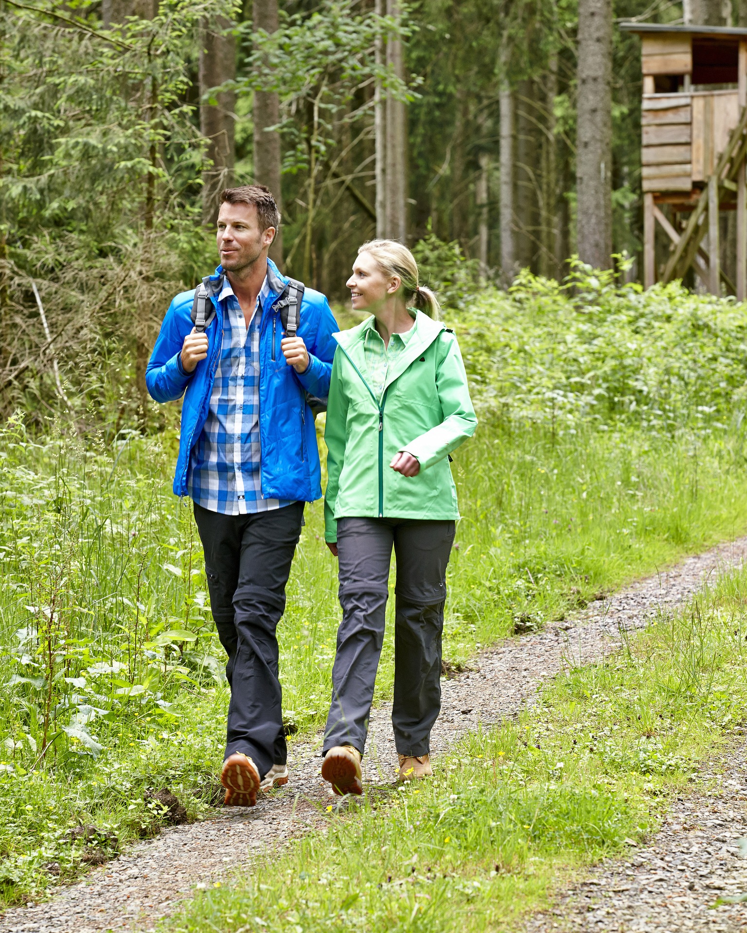
Braunlage
Wetterstation – Waldmuehle- Rinderstall (Weather Station - Forest Mill - Cattle Barn)
|
Length: |
about 6 km |
|
Altitude: |
600 - 630 meters above sea level |
|
Start: |
Weather Station in, von-Langen-Street |
|
Finish: |
Forest Restaurant "Rinderstall" (Cattle Barn) |
|
Description: |
Pass the youth hostel direction parent-child sanatorium "Waldmuehle" (Wood Mill), downhill along the Morgensternweg towards the Odertal Valley, then right towards the final destination - the forest restaurant "Rinderstall" (Cattle Barn) |
|
Level: (1 = easy, 6 = difficult) |
3 |
|
Comments: |
Tour route, refreshments available on route, family-friendly, secret little gem |
Mount Wurmberg Walk
|
Length: |
about 6,5 km |
|
Altitude: |
550 - 970 meters above sea level |
|
Start: |
Cable car station at the foot of Mount Wurmberg |
|
Finish: |
Cable car station at the top of Mount Wurmberg |
|
Description: |
Follow the signs "Rundweg" (Circular Route) from the playground by the cable car station at the foot of Mount Wurmberg, just below the Maritim Hotel. Then follow the trail 35D towards the Brockenberg ski jump, where you turn onto the Soegdingsweg 35H, which leads to the cable car station on the top of Mount Wurmberg. |
|
Level: (1 = easy, 6 = difficult) |
5 |
|
Comments: |
Tour route, stunning views, refreshments available on route, family friendly, climb up to the top and down again, summit tour, secret little gem |
Circular routes around Braunlage
|
Length: |
about 6,5 km |
|
Start: |
Just above the indoor adventure swimming pool in the Ramsenweg |
|
Finish: |
Just above the indoor adventure swimming pool in the Ramsenweg |
|
Description: |
Circular route around Braunlage |
|
Level: (1 = easy, 6 = difficult) |
3 |
|
Comments: |
Circular route, stunning views, refreshments available on route, family friendly |
Hohegeiss
Alte Bobbahn – Wolfsbachtal – Gretchental
|
Length: |
about 6 km |
|
Start: |
Schuetzenplatzweg (Adventure Days Harz) |
|
Finish: |
Kurpark Hohegeiss |
|
Description: |
From the starting point at the Schuetzenplatzweg turn into Bohlweg, pass the former hotel "Dicke Tannen", down the old bob sleigh until Wolfsbachstrasse. Then uphill towards Hohegeiss to the Gretchental and the Kurpark Hohegeiss. |
|
Level: (1 = easy, 6 = difficult) |
3 |
|
Comments: |
Circular route, refreshments available on route, botanical highlights |
Horizontalweg – Nullpunkt – Bechlerstein
|
Length: |
about 10 km |
|
Start: |
Car park at the Bechlerstein, about 1 km north of Hohegeiss, turn left at the B4 towards Heimathuette (hut) |
|
Finish: |
Car park at the Bechlerstein |
|
Description: |
At the Bechlerstein go south and turn into Wolfsbachstrasse . After 1 km pass the Koehlerhuette (Charcoal Burner's Hut) and turn right into the Horizontalweg until the Nullpunkt (Point Zero - a topographic survey point). Here, turn right into the Ebersbergstrasse, go east and follow this road until the Bechlerstein. |
|
Level: (1 = easy, 6 = difficult) |
2 |
|
Comments: |
Circular route, stunning views |
Am Lampertsberg
|
Length: |
about 5 km |
|
Start: |
Car park at the Forest Lido, Baerenbachweg |
|
Finish: |
Car park at the Forest Lido, Baerenbachweg |
|
Discription: |
You start at the forest lido and walk uphill to the northeast until you reach the top of Mount Lampertsberg. Then keep right to the northwest down to the car park again. |
|
Level: (1 = easy, 6 = difficult) |
3 |
|
Comments: |
Circular routes, stunning views, refreshments available on route, family friendly, along the ridge |
Hohegeiss – Bechlerstein – Wolfsbachtal – Zorge
|
Length: |
about 8km |
|
Start: |
Car park - northeast entrance of Hohegeiss |
|
Finish: |
Zorge |
|
Description: |
You start at the car park and walk about 300 meters direction North, along the pedestrian walkway, then cross the B4 and follow until Bechlerstein, turn left on Wolfsbachstrasse. From there follow the road about 7km to the north entrance of Zorge. You can now walk back the same route or catch a bus back to Hohegeiss. |
|
Level: (1 = easy, 6 = difficult) |
2 |
|
Comments: |
Tour route, refreshments available on route, botanical highlights |
Sankt Andreasberg
Kurhaus – Rehberger Grabenhaus - Oderteich
|
Length: |
about 11 km |
|
Altitude: |
630 - 645 meters above sea level |
|
Start: |
Wandertreff by the Kurhaus |
|
Finish: |
Oderteich |
|
Description: |
Kurhaus to Dreibrode car park, direction Rehberger Grabenhaus. Then walk along the Rehberger Graben until Goetheplatz, past to Sarghai hut to the Oderteich (Oder pond). The Oderteich was built between 1715 to 1722 and is the oldest dam within the Harz and together with the Rehberger Graben are part of the UNESCO World Cultural Heritage "Upper Harz Water Management System". |
|
Level: (1 = easy, 6 = difficult) |
1-3 |
|
Comments: |
Tour route |
Kurhaus – Braunlager Strasse- Matthias Baude (hut)
|
Length: |
about 2 km |
|
Altitude: |
630 - 645 meters above sea level |
|
Start: |
Wandertreff by the Kurhaus (meeting point ) |
|
Finish: |
Matthias Baude (Matthias Hut) |
|
Description: |
Kurhaus, Braunlager Strasse, past the restaurant "Roter Bear" and walk along until Eschberger Planweg. Here turn right and stay on the Eschberger Planweg until you reach the Matthias Schmidt hut. From there you get a unique view towards the snowy mountain town and the skiing resort. You can now walk back the same route or take the lift down to the valley and follow the way pass the Waeschegrund back to the town. |
|
Level: (1 = easy, 6 = difficult) |
1-2 |
|
Comments: |
Tour route |
Kurhaus – Lochchaussee – Rinderstall – Oderhaus
|
Length: |
about 8 km |
|
Altitude: |
432 - 630 meters above sea level |
|
Start: |
Wandertreff by the Kurhaus (meeting point ) |
|
Finish: |
Oderhaus |
|
Description: |
Kurhaus St. Andreasberg, down the Clausthaler-Strasse into the Braunlager-Strasse, then turn left, up the Strasse “Am Gesehr“. Follow straight to Jordanshoehe. Take the way down between the Naturfreundehaus (friends of nature house) on the left and Eichsfelderhuette (hut) on the right to the Rehberger Graben in direction Rehberger Grabenhaus. At the first intersection follow the signs to "Rinderstall" down, pass the Lochchaussee to the Odertalstrasse, which you follow to the right until "Rinderstall". If you wish, treat yourself in good snow conditions to sledging fun (3 km downhill run) or continue to the Oderhaus towards the National Park Administration Office. After the 8 km hike, you can take the bus back to St. Andreasberg. |
|
Level: (1 = easy, 6 = difficult) |
3-4 |
|
Comments: |
Tour route |
Circular route Kuppe
|
Length: |
about 4 km |
|
Altitude: |
630 - 730 meters above sea level |
|
Start: |
Wandertreff by the Kurhaus (meeting point ) |
|
Finish: |
Wandertreff by the Kurhaus (meeting point ) |
|
Description: |
Kurhaus – Jordanshoehe – Gesteinskundlicher Lehrpfad – Neigenfindthof- Andreasheim - An der Skiwiese - Kurhaus |
|
Level: (1 = easy, 6 = difficult) |
3-4 |
|
Comments: |
Circular route |
For further questions please do not hesitate to contact our tourist information:
|
Tourist Information Braunlage |
Tourist- Information Hohegeiss |
Tourist Information St. Andreasberg |
|
Elbingeroeder Strasse 17 |
Kirchstrasse 12a |
Am Kurpark 9 |
|
38700 Braunlage |
38700 Hohegeiss |
37444 St. Andreasberg |
|
Tel: +49 (0) 55 20 / 93 07 0 |
Tel: +49 (0) 55 83 / 2 41 |
Tel: +49 (0) 55 82 / 80 33 6 |
|
Fax: +49 (0) 55 20 / 93 07 20 |
Fax: +49 (0) 55 83 / 12 35 |
Fax: +49 (0) 55 82 / 80 33 9 |
|
E-Mail: tourist-info@braunlage.de |
E-Mail: tourist-info@hohegeiss.de |
E-Mail: info@oberharz.de |
|
|
|
|